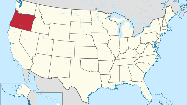
State of Oregon

State of Oregon

Geography
Capital city Salem Biggest city Portland Surface 255,026 km² Population 4,246,000 Length of highway network 1,247 km First highway 1955 Abbreviation OR Oregon is a state in the United States, located on the west coast. The state has 4.2 million inhabitants (2021), on 255,026 km², more than six times the size of the Netherlands. The capital is Salem, the largest city is Portland. Geography I-84 in the Columbia River Gorge. Oregon is located on the Pacific coast of the United States and borders the states of Washington, Idaho, Nevada, and California. The state measures a maximum of 600 kilometers from west to east and 480 kilometers from north to south. The state belongs to the Pacific Northwest region. The state has a very diverse landscape, with the spectacular coastline rising…
Read More
State of Pennsylvania

State of Pennsylvania

Geography
Capital city Harrisburg Biggest city Philadelphia Surface 119,283 km² Population 12,964,000 Length of highway network 4.225 km First highway 1940 Abbreviation PA Pennsylvania is a state in the northeastern United States. The capital is Harrisburg and the two most famous cities are Philadelphia and Pittsburgh. The state has 12.9 million inhabitants (2021) and has an area of 119,283 square kilometers, making it three times the size of the Netherlands. Geography I-80 in Northern Pennsylvania. Pennsylvania is located in the northeastern United States and borders the states of New York, New Jersey, Delaware, Maryland, West Virginia, and Ohio clockwise. Across Lake Erie, it borders Canada, namely the province of Ontario. Although Pennsylvania does not have a classic coastline, it is connected to the sea via the Delaware River, because this is…
Read More
State of Rhode Island

State of Rhode Island

Geography
Capital city Providence Biggest city Providence Surface 4,002 km² Population 1,096,000 Length of highway network 195 km First highway 1953 Abbreviation RI Rhode Island is the smallest state in the United States. The state is located in the northeast and has 1 million inhabitants (2021). The capital is Providence. The state has an area of 4,002 kilometers, the size of a Dutch province. I-95 at Downtown Providence. Geography Rhode Island is located in the northeastern United States on the Atlantic Ocean. The state is named after Rhode Island, an island off the Rhode Island Sound and Narragansett Bay, south of the state capital Providence. The state has a relatively long coastline and is not called "the ocean state" for nothing. The state measures a maximum of 60 kilometers from east…
Read More
State of South Carolina

State of South Carolina

Geography
Capital city Columbia Biggest city Charleston Surface 82,932 km² Population 5,191,000 Length of highway network 1,490 km First highway 1957 Abbreviation SC South Carolina is a state in the United States. The state is located on the Atlantic Ocean and has 5.1 million inhabitants (2021). The capital is Columbia, the largest city is Charleston. The state has an area of 82,931 square kilometers and is twice the size of the Netherlands. Geography South Carolina is located in the southeastern United States, on the Atlantic Ocean. The state borders North Carolina and Georgia and measures a maximum of 350 kilometers from north to south and 450 kilometers from west to east. The state is roughly in the shape of a triangle. South Carolina is mostly quite flat, except the extreme northwest…
Read More
State of South Dakota

State of South Dakota

Geography
Capital city Pierre Biggest city Sioux Falls Surface 199,905 km² Population 895,000 Length of highway network 1,091 km First highway 1958 Abbreviation SD South Dakota is a state in the northern United States. The state has 895,000 inhabitants (2021) and the capital is Pierre. The largest city is Sioux Falls. Geography I-90 on the Great Plains near Pierre. South Dakota is located in the northern United States, on the Great Plains. The state clockwise borders North Dakota, Minnesota, Iowa , Nebraska, Wyoming, and Montana. The state measures a maximum of 610 kilometers from west to east and 380 kilometers from north to south. So South Dakota is a large state and sparsely populated. The Missouri River first forms the southern border and then flows through the center of the state…
Read More
State of Tennessee

State of Tennessee

Geography
Capital city Nashville Biggest city Nashville Surface 109,247 km² Population 6,975,000 Length of highway network 2,220 km First highway 1952 Abbreviation TN Tennessee is a state in the southeastern United States. The state has 6.9 million inhabitants (2021) and the capital and largest city is Nashville. The most historic city is Memphis. The state has an area of 109,247 square kilometers and is therefore about 3 times the size of the Netherlands. Geography Stretched greatly in the east-west direction, Tennessee borders many states, to the north to Kentucky and Virginia, to the east to North Carolina, to the south to Georgia, Alabama, and Mississippi, and to the west to Arkansas and Missouri. The state measures a maximum of 720 kilometers from west to east and 185 kilometers from north to…
Read More
State of Texas

State of Texas

Geography
Capital city Austin Biggest city Houston Surface 696,241 km² Population 29,528,000 Length of highway network 7,206 km First highway 1948 Abbreviation TX Texas is a state in the United States. The state is located in the central south of the country and is considered both a southern and southwestern state. Its nickname is the Lone Star State. It is the second largest state in both land area and population with a population of 29.5 million in 2021. Texas has a number of major cities, such as Houston, Dallas, San Antonio, and the capital Austin. Texas is vast and contains many different landscapes, although a fairly large part of the state is flat, with forests in the east, prairies in the middle and steppe and desert in the west. The state…
Read More
State of Utah

State of Utah

Geography
Capital city Salt Lake City Biggest city Salt Lake City Surface 219,887 km² Population 3,338,000 Length of highway network 1,529 km First highway 1956 Abbreviation UT Utah is a state in the western United States. The capital and largest city is Salt Lake City. The state has 3.3 million inhabitants (2021) and has an area of 219,887 square kilometers, more than 5 times the size of the Netherlands. Geography I-15 near Nephi, with a view of Mount Nebo (3635 m). Utah is located in the Intermountain West region, just west of the Rocky Mountains. The state borders Idaho, Wyoming, Colorado, Arizona and Nevada, and also New Mexico through the 'Four Corners'. Utah is a large state, it measures a maximum of 555 kilometers from north to south and 445 kilometers…
Read More
State of Vermont

State of Vermont

Geography
Capital city Montpelier Biggest city Burlington Surface 24,923 km² Population 646,000 Length of highway network 589 km First highway 1958 Abbreviation VT Vermont is a state in the United States. The state is located in the northeast of the country, and has 646,000 inhabitants (2021). The capital is Montpelier, the largest city is Burlington. The state has an area of 24,923 square kilometers and is more than half the size of the Netherlands. Geography I-91. Vermont is a rural state in the northeastern United States, part of the New England region. The state borders Canada, on the province of Québec. It also borders the states of New Hampshire, Massachusetts and New York. The state measures a maximum of 250 kilometers from north to south and a maximum of 150 kilometers…
Read More
State of Virginia

State of Virginia

Geography
Capital city Richmond Biggest city Virginia Beach Surface 110,786 km² Population 8,642,000 Length of highway network 2,394 km First highway 1941 Abbreviation VA Virginia is a state in the eastern United States. The state is located on the Atlantic Ocean and has 8.6 million inhabitants (2021). The capital is Richmond and the largest city is Virginia Beach, part of the Hampton Roads conurbation. The state has an area of 110,785 square kilometers and is almost 3 times the size of the Netherlands. Richmond, the capital of Virginia. Geography Virginia is located on the east coast of the United States, although the open sea coastline is relatively short relative to the size of the state. The state is bordered by North Carolina and Tennessee to the south, Kentucky and West Virginia…
Read More
State of Washington

State of Washington

Geography
Capital city Olympia Biggest city Seattle Surface 184,827 km² Population 7,738,000 Length of highway network 1,555 km First highway 1940 Abbreviation WA Washington is a state in the northwestern United States. The state's nickname is the Evergreen State, and its capital is Olympia. The largest city is Seattle. The state itself has 7.7 million inhabitants (2021). The state is often referred to as Washington State, to distinguish it from the capital Washington, DC Geography I-90 at the Columbia River. Washington is part of the Pacific Northwest region, and is located on the Pacific Ocean. The state has a long border with Canada, on the province of British Columbia, and further borders the states of Idaho to the east and Oregon to the south. Washington measures a maximum of 570 kilometers…
Read More
State of West Virginia

State of West Virginia

Geography
Capital city Charleston Biggest city Charleston Surface 62,755 km² Population 1,783,000 Length of highway network 924 km First highway 1954 Abbreviation WV West Virginia is a state in the United States. The state is located in the east of the country and has 1.7 million inhabitants (2021). The capital and largest city is Charleston. The state measures 62,755 square kilometers, making it more than twice the size of the Netherlands. Geography US 48 at Moorefield. Located in the Appalachian Mountains, West Virginia is a little tricky to place geographically, as it doesn't really fall under the East Coast, Northeast, Midwest, or South. The state borders Pennsylvania, Maryland, Virginia, Kentucky and Ohio. The state has a distinctive shape and measures a maximum of 360 kilometers from north to south and 350…
Read More
State of Wisconsin

State of Wisconsin

Geography
Capital city Madison Biggest city Milwaukee Surface 169,790 km² Population 5,896,000 Length of highway network 1,915 km First highway 1953 Abbreviation WI Wisconsin is a state in the northern United States. The state is located in the Great Lakes region, and has 5.8 million inhabitants (2021). The capital is Madison, the largest city is Milwaukee. The state has an area of 169,790 square kilometers and is therefore more than four times the size of the Netherlands. I-41 between Oshkosh and Fond du Lac. Geography Wisconsin is located on the western side of the Great Lakes region, which has a shoreline on Lake Michigan and Lake Superior. The state borders Michigan, Illinois, Iowa, and Minnesota. The state measures a maximum of 500 kilometers from north to south and 470 kilometers from…
Read More
State of Wyoming

State of Wyoming

Geography
Capital city Cheyenne Biggest city Cheyenne Surface 253,348 km² Population 579.000 Length of highway network 1,473 km First highway 1958 Abbreviation WY Wyoming is a state in the United States. The state has 579,000 inhabitants (2021) and the capital and largest city is Cheyenne. Geography City Population Cheyenne 65,000 Casper 59,000 laramie 32,000 Gillette 31,000 Wyoming is located in the western United States, on the transition from the High Plains to the Rocky Mountains. The state clockwise borders Montana, South Dakota, Nebraska, Colorado, Utah, and Idaho. The state has boundaries along latitudes and longitudes, forming a square with them. The state measures 600 kilometers from west to east and 440 kilometers from north to south. It is the ninth largest state in the United States by area. The Rocky Mountains…
Read More
Fresno, California

Fresno, California

Geography
  Fresno City in the United States Location State California County Fresno County Coordinates 36°46'54"N, 119°47'32"WL General Surface 297.07 km² - country 296.34 km² - water 0.73 km² Residents (April 1, 2020) 542,107 (1829 inhabitant/km²) Politics Mayor Jerry Dyer (R) Website fresno.gov The center (downtown) of Fresno Portal United States California According to iamaccepted, Fresno is a city in the middle of the US state of California and the county seat of Fresno County. The city is located in the San Joaquin Valley, which is part of the Central Valley, and had an estimated population of 527,438 in 2017. It is the largest city in California's San Joaquin Valley, the 34th largest city in the country (behind Tucson). and ahead of Sacramento) and fifth by state (behind San Francisco and…
Read More
Salt Lake City, Utah

Salt Lake City, Utah

Geography
Salt Lake City, the capital and largest city of the US state of Utah, is located on the southeastern shores of the Great Salt Lake. It was founded in the middle of the 19th century by the Mormon prophet Brigham Young, who brought his religious community here to the promised land. To this day, Salt Lake City is the headquarters of the Mormon Church. Welcome to Deseret State The Shoshone, Ute and Paiute Indian tribes were the original inhabitants of the area where present-day Salt Lake City is located. Europeans arrived in these places only in the middle of the 19th century. It was 1847 when a group of 148 Mormons led by Brigham Young (1801-1877) came to the shores of the Great Salt Lake from Missouri. Young was the…
Read More
Aberdeen, South Dakota

Aberdeen, South Dakota

Geography
To the northeast of the capital Pierre, in the flat landscape of South Dakota, lies the town of Aberdeen, which is the county seat of Brown County. The city currently has around 27,000 inhabitants, but the entire metropolitan area, which also includes the surrounding regions, has approximately 40,000 inhabitants. According to existingcountries, Aberdeen is located in the northeastern part of the state, in the valley of the James River, which is dammed by two reservoirs near the city. The peaceful Moccasin Creek flows through the city, which then flows into the James River. The first settlers of the area were the Sioux Indians around 1700-1879. The first white settlers came to the county in the first half of the 19th century, mainly for the fur trade. They established many trading…
Read More
About Educational Diagnosis

About Educational Diagnosis

Definitions
Before entering fully into the meaning of the term educational diagnosis, we are going to know the etymological origin of the two words that give it shape: -Diagnosis comes from the Greek, exactly from “diagnostikos”, which can be translated as “through knowledge”. This word is the result of the union of three different parts: the prefix “dia-”, which means “through”; the noun “gnosis”, which is synonymous with “knowledge”; and the suffix “-sis”, which is used to indicate the action. -Educational, on the other hand, has its etymological origin in Latin. It is the result of the sum of several components of said language: the prefix “ex-”, which is synonymous with “out”; the verb “ducere”, which means “to guide”; and the suffix “-tivo”, which is used to indicate “active or passive…
Read More
About Enlightened Despotism

About Enlightened Despotism

Definitions
The concept of despotism is linked to the abuse of power, whether moral or physical, imposing the use of force in dealing with a certain group of people. This concept is usually linked to a type of government that has absolute power and whose actions are not limited by existing laws. The concept of enlightened, in turn, is related to that belonging to or related to illustration (the philosophical and cultural movement that emerged in the eighteenth century that postulated the predominance of reason over emotions and that considered that in the use of intelligence resided in the progress of all humanity). See Abbreviation Finder for acronyms related to enlightened. During the Enlightenment a type of government existed that became known as enlightened despotism. Although at first glance this word may…
Read More
About Tear

About Tear

Definitions
A tear is a break or break. The term is often used to name a muscle tear, which is an injury to muscle tissue with damage to interior fibers and rupture of blood vessels. For example: "The Chilean striker suffered a tear and will not play for two weeks", "López has suddenly stopped running: it seems that he has just suffered a tear", "This season I have missed four tournaments since I had two tears and one pubalgia”. The tear can be caused by contraction (with an effort that exceeds the biological capacity of the muscle to resist tension) or elongation (by excessive stretching). A proper warm -up before physical activity reduces the possibility of suffering a tear, although it does not eliminate it completely. Strain can also be caused…
Read More
About Descendant

About Descendant

Definitions
Descendant is any person who is descended from another, such as a grandchild or a child. The concept is associated with the notion of kinship (the blood relationship or union by virtue of law). If we consider the case of an individual, those generations of his family that preceded his arrival in the world are known as ancestors. Great-great-grandparents, great-grandparents, grandparents, and parents are ancestors of a person. Those who follow a person in their family tree are their descendants (children, grandchildren, etc.). See Abbreviation Finder for acronyms related to Descendant. What is a descendant The descendants of a subject, therefore, are the generations that follow it in the family tree: children, grandchildren, great- grandchildren , great-great- grandchildren, etc. Of course, a subject can be ascendant or descendant, depending on…
Read More
About Commercial Law

About Commercial Law

Definitions
Within the multiple branches of law, commercial law (also known as commercial law) is that dedicated to regulating relationships between people, contracts and commercial actions. Commercial law is part of private law and includes all the rules related to merchants in reference to the development of their work. At a general level, it could be said that it is the branch of law that regulates the exercise of commercial activities. Commercial law regulates the exercise of commercial activities. See Abbreviation Finder for acronyms related to Commercial Law. Sources of commercial law It is important to make clear what are the sources of the aforementioned commercial law. In this case we can establish that these are the law, the jurisprudence that is the interpretation that the judge and the rest of…
Read More
About Denotation

About Denotation

Definitions
From the Latin denotatio, denotation is the action and effect of denoting (a verb that, said of a word or phrase, mentions its objective meaning). Concept functions as the opposite of connotation. The denotation is linked to the meaning of the referential mechanism with the information that a linguistic unit transmits. It is an explicit meaning, unlike connotation, whose meaning is suggested since the semantic value is not given by a lexical signifier. Trademarks provide an example of how denotation and connotation work. A bar named The Old Bridge Pub has a denotative sense (the name that specifically identifies it as The Old Bridge Pub) and a connotative sense (the English phrase suggests that it is a British-style pub). Most of the brands, in general, go beyond the denotation and…
Read More
About Thin

About Thin

Definitions
The adjective thin comes from the Latin word delicātus. Applied to a person, it refers to someone who is skinny, of little weight. For example: “You are very thin, do you eat properly?” , "I am looking for my nephew: he is a tall, thin boy with brown hair", "The thin actor had to change his physiognomy to play the president in his new movie". According to today's conventional aesthetic standards, thinness is often considered attractive. A thin individual, in this framework, has a better chance of succeeding in the world of fashion or in the entertainment industry than an overweight person. However, those who are thin may suffer from some type of eating disorder or other problem. Only a health professional can indicate the appropriate weight of a subject.…
Read More
About Cryosphere

About Cryosphere

Definitions
The notion of cryosphere is not part of the dictionary prepared by the Royal Spanish Academy ( RAE ). The concept, however, is often used with reference to the surface water of our planet that is in a solid state due to low temperatures. The cryosphere, in this setting, is made up of the Earth 's large masses of ice and snow. Therefore we can find the cryosphere in Antarctica and the North Pole, among many other regions, such as Greenland, Northern Siberia, the Arctic Ocean and Northern Canada and most of the peaks of the highest mountain ranges. of the world. When the cryosphere originates from the freezing of the oceans, it does not affect the sea level, since solid water is formed from it. On the other hand,…
Read More
About Guilt

About Guilt

Definitions
Guilt is an imputation made to someone for a behavior that generated a certain reaction. It is also known as guilt to the fact that it is the cause of something else. For example: "The actor's family assures that the star committed suicide because of journalistic harassment", "My grandfather had to leave the country because of political persecution", "Television is no longer useful because of the electrical storm that burned the circuits”. In law, fault implies the omission of due conduct to prevent and avoid damage. Abbreviationfinder: Find definitions of English word - Automotive. Commonly used abbreviations related to word are also included. Fault in law In the field of law, guilt refers to the omission of diligence required of a subject. This implies that the harmful act imputed to…
Read More
About Quarantine

About Quarantine

Definitions
The notion of quarantine has several uses. In general, the term is used to name a period of forty days (although, sometimes, it can also be a temporal compendium of forty months or forty years ). Specifically, it is considered that quarantine is a term that began to be used forcefully in the 14th century as a result of the advance of the Black Death. Thus, at that time those who had been infected by it and had managed to survive it was established that they should spend forty days in isolation before being able to relate to the rest of the citizens again. Another possibility is that quarantine refers to the forty equally sized portions into which something can be divided; to a thing formed by forty components or…
Read More
About Bloody

About Bloody

Definitions
The bloody adjective, which comes from the Latin word cruentus, is used to qualify someone or something that is bloody or ferocious. For example: "This bloody war has already claimed thousands of lives", "A bloody confrontation between the police and a gang of criminals ended with three dead and five injured", "The drug traffickers are immersed in a bloody battle for dominance territory of the area”. A situation is classified as bloody when it involves bloodshed. Suppose that two groups of young people, leaving a nightclub, get into a fight. These people have knives and also begin to collect blunt objects that they find on public roads: stones, bottles, etc. As a result of the dispute, two adolescents die and another six end up hospitalized. Given this terrible balance, it…
Read More
About Deja Vu

About Deja Vu

Definitions
Déjà vu or deja vu is a French term meaning "already seen". The concept describes the sensation that a person experiences when thinking that they have previously experienced an event that, in reality, is new. The person responsible for coining the term was Émile Boirac, a French parapsychologist who was born in 1851 and died in 1917. Phrases where the term appears: «I had a déjà vu: I feel like I've been in this house before», «I saw the news and thought it was déjà vu», «Tell Claudio that it's not déjà vu: I already told him how ten times that you have to read the report and make a summary». A deja vu implies experiencing something that is familiar and, at the same time, strange. Abbreviationfinder: Find definitions of…
Read More
About Decreasing

About Decreasing

Definitions
Before entering fully into the meaning of the term decreasing, it is necessary to know its etymological origin. In this case, we can point out that it is a word that derives from the verb to decrease, which, in turn, derives from the Latin verb “descrecere”, which can be translated as “to decrease”. Specifically, this verb form is made up of two different parts: -The prefix “de-”, which is used to indicate “from top to bottom”. -The verb “crescere”, which is synonymous with “to grow”. The decreasing adjective is used to qualify that which decreases : that is, it decreases or decreases. The concept is used in multiple contexts. The law of diminishing returns states that if one factor of production is added but the rest is left unchanged, there…
Read More